
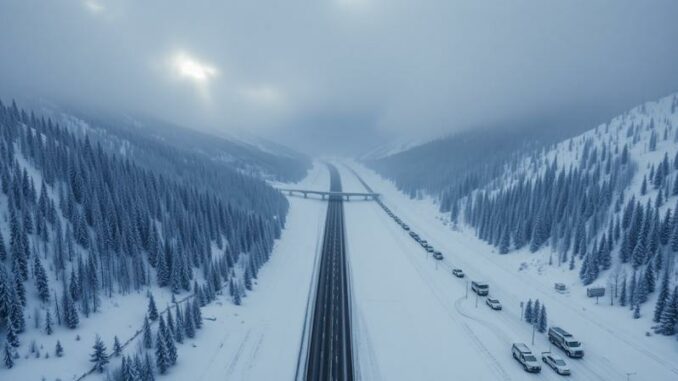
A powerful late-season winter storm is sweeping across parts of the western United States, bringing the threat of heavy snowfall, strong wind gusts, and dangerous travel conditions from Sunday into Monday. Forecasters are warning that some mountain regions could receive up to 16 inches of snow, while blowing snow and sharply reduced visibility may create hazardous conditions across major highways and mountain passes.
The storm is expected to impact portions of Wyoming, Montana, Utah, Washington, and Oregon, with the most severe conditions forecast in Wyoming’s mountain regions. Winter storm warnings and winter weather advisories remain in effect as the system intensifies across the Rockies and Pacific Northwest.
Wyoming Braces for the Harshest Winter Conditions
Wyoming is expected to experience the worst of the storm, particularly in central and northern parts of the state where snowfall totals could become significant by Monday night.
Meteorologists say the Wind River Mountains East could receive between 8 and 16 inches of snow, accompanied by wind gusts reaching 50 mph. Those conditions may produce near-whiteout visibility at times, especially along exposed ridges and mountain highways.
Other parts of the state are also expected to see substantial snowfall accumulations.
Major Snow Totals Expected Across Wyoming
Wind River Mountains East
Forecast snowfall totals range from 8 to 16 inches, making this one of the hardest-hit areas during the storm.
Casper Mountain
Snowfall amounts between 7 and 14 inches are possible, with strong winds creating drifting snow and icy roadways.
Green Mountains and Rattlesnake Range
Communities near Jeffrey City may see between 6 and 11 inches of snow as the system pushes eastward.
Natrona County and Casper
Lower elevations could still receive 3 to 5 inches, with isolated spots approaching 7 inches.
Absaroka and Bighorn Mountains
Most areas are expected to pick up 4 to 8 inches, though higher elevations could see totals near 12 inches.
Wind River Basin
Snow accumulations will likely be lighter here, generally between 1 and 4 inches.
Montana Mountain Passes Facing Snow and Reduced Visibility
Montana will also see widespread winter weather impacts, particularly along the Rocky Mountain Front and mountainous terrain near the Wyoming border.
Forecasters warn that several mountain passes may become difficult to navigate due to slick roads and blowing snow.
Snowfall Forecast for Montana
Pryor and Northern Bighorn Mountains
Snowfall totals between 5 and 10 inches are expected in higher elevations.
Rocky Mountain Front
Most locations are forecast to receive 2 to 6 inches, though isolated peaks could approach 12 inches.
Red Lodge and Beartooth Foothills
Up to 4 inches of snow may accumulate by late Sunday night.
Strong winds may continue to create visibility concerns throughout the region, especially during heavier bursts of snow.
Utah’s Uinta Mountains Could See More Than a Foot of Snow
The storm system is also expected to impact the Uinta Mountains in Utah, extending into nearby southwestern Wyoming.
Winter weather alerts remain active as colder air combines with moisture to produce significant mountain snowfall.
Uinta Mountains Snowfall Predictions
Western Uinta Mountains
Forecasters are predicting between 6 and 14 inches of snow, with isolated higher amounts possible in the tallest peaks.
Eastern Uinta Mountains
Areas above 8,500 feet could see 6 to 12 inches by Monday night.
Travel through higher elevations may become increasingly dangerous as snow-covered roads and gusty winds develop overnight.
Pacific Northwest Also Facing Snowy Conditions
While snowfall totals in Washington and Oregon are expected to be lower than those in the Rockies, the Cascades could still see enough snow to create temporary travel disruptions.
Higher elevations above 4,000 feet are most likely to experience accumulating snowfall.
Washington and Oregon Forecast Totals
Washington Cascades
Around 3 inches of snow is possible above 4,000 feet.
Oregon Cascades
Most areas could receive 1 to 3 inches above 4,000 feet, while elevations above 5,000 feet may pick up between 4 and 6 inches.
Road temperatures may initially limit accumulation on some highways, but heavier snow showers could still create brief hazardous driving conditions.
Dangerous Travel Conditions Expected Across Multiple States
Officials are warning drivers to prepare for rapidly changing weather and deteriorating road conditions through Monday.
The combination of heavy snowfall and strong winds is expected to create blowing snow and poor visibility across several major transportation routes.
Areas Likely to Experience Travel Problems
South Pass in Wyoming
One of the most concerning travel corridors during the storm, with periods of heavy snow and low visibility expected.
Highway 14 Through the Bighorn Mountains
Snow-covered roads and drifting snow may make travel difficult.
Interstate 80 in Sweetwater County
Drivers could encounter slick roads, sudden visibility drops, and dangerous crosswinds.
Montana Mountain Passes
Homestake Pass, Rogers Pass, and MacDonald Pass are all expected to face winter driving hazards.
High-Elevation Routes in the Cascades and Uintas
Mountain travel may become slow and dangerous as snowfall intensifies overnight.
Forecasters are urging motorists to carry emergency supplies including blankets, food, water, flashlights, and shovels in case conditions worsen unexpectedly.
Blowing Snow and Strong Winds Could Create Near-Whiteout Conditions
One of the most serious concerns with this storm is the potential for blowing snow caused by strong wind gusts.
Wind speeds of 40 to 50 mph are expected in some mountain areas, dramatically reducing visibility and increasing the risk of accidents.
Even locations that receive moderate snowfall totals may still experience dangerous conditions due to drifting snow and icy roads.
Bridges, overpasses, and elevated roadways are expected to freeze first, creating especially slippery conditions during the overnight and early morning hours.
Monday Commutes and Outdoor Plans May Be Disrupted
The timing of the storm could affect both morning and evening commutes on Monday across parts of Wyoming and Montana.
Snowfall rates may intensify during key travel periods, leading to slower traffic, road closures, and delays in higher elevations.
Additional Concerns During the Storm
Backcountry Risks Increasing
Cold temperatures, wet snow, and strong winds may increase the risk of hypothermia for hikers, campers, and outdoor workers.
Skiing and Recreation Impacts
Outdoor recreation areas could face dangerous conditions despite fresh snowfall, especially in exposed mountain terrain.
Isolated High-Elevation Communities
Communities in mountainous regions may experience temporary access issues if roads become impassable during heavier snowfall.
Forecasters continue to monitor the storm closely as it moves across the western United States, with additional advisories possible if conditions intensify further through Monday night.

Leave a Reply